ByMuR input description |
To exchange datasets originated from different groups, sources or algorithms, some dedicated XML schemas has been defined. The inspiration has been taken from the formats defined by GEM1 (Global Earthquake Model). XML schemas defined by GEM’s sub-project Natural hazards’ Risk Markup Language (NRML) for hazard, fragility and loss models have been initially simplified to avoid useless complexity in parsers (e.g. no continuous functions are used in ByMuR) and then expanded to reach the expressive power required.
In fact GEM formats are designed to manage seismic hazard and risk only, while ByMuR project is primarily focused on risks comparison between different origin phenomena. Because of this, the first necessary modification was the introduction of specifics XML tags and attributes along all file formats, allowing users to specify everywhere which kind of hazard they are referring to.
In datasets epistemic uncertainty of results is managed with the presence of multiple files, one for each percentile taken in exam plus one for the average hazard (or fragility, loss, risk).
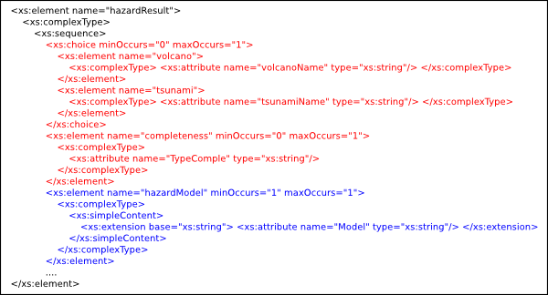
Three mutually exclusive tags were introduced: volcano, tsunami and completeness to determine which kind of phenomena the model is referred to (figure 2).
Also the hazarModel tag has been introduced with an attribute Model: the tag contains the single hazard model name, while the attribute contains the name of theoretical model used to calculate hazard values (see the example in Figure 3).
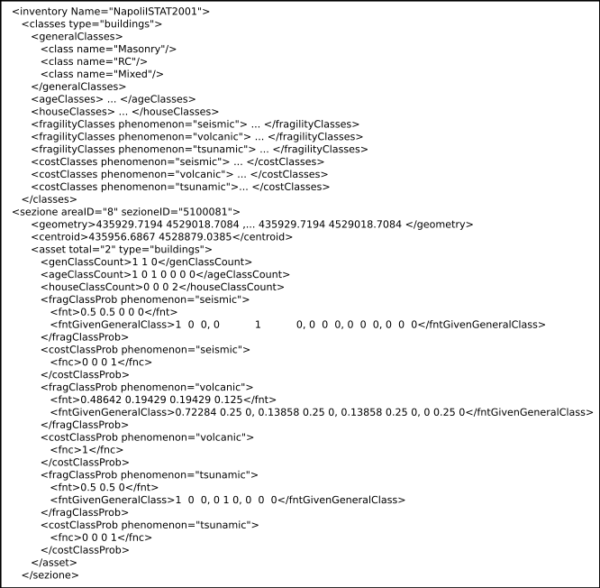
Inventory file is expected to contain:
In ByMuR, inventory file is originated from the most updated ISTAT shape files, available for the municipality of Naples. In Figure 4 an example is shown.
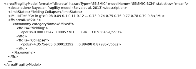
Fragility models (as for loss and risk) are calculated on the basis of the areas defined by the user and the root tag is called arealFragility. A curve is defined for each area, each general building class (specified by the taxonomy tag attribute), and for each limit state.
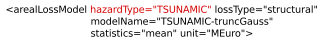
As in the hazard case, the most noticeable modification from GEM’s original specification consists in the addition of the attribute hazardType in the root tag (Figure 5).
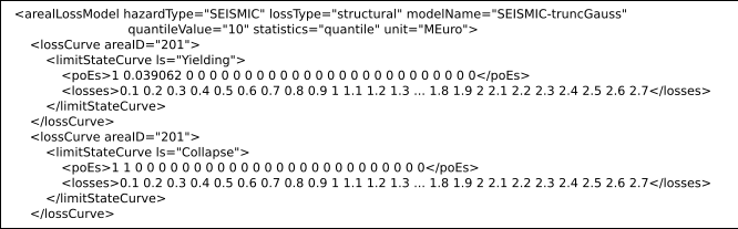
For each area in a loss model there are multiple curves to plot, one for each limit state defined in the corresponding fragility model. This correspondence is enforced not in areasLossModel tag, bug in the resulting risk model XML file, where all models that contribute to risk computation are listed in main tag attributes (figure 6).
Risk models are the final results of computation and the attributes hazardModelName, fragilityModelName and lossModelName are specified in the root tag arealRiskModel (figure 7).